Formation and Ice Age River Shifts
The origin of Rhine Falls (Rheinfall) dates back approximately 14,000 to 17,000 years during the transition of the last glacial period. Successive glaciations repeatedly redirected the course of the Rhine River across the northern Swiss plateau. The current riverbed was formed when the Rhine abandoned its previous gravel channel and cut into a resistant ridge of Upper Jurassic limestone.
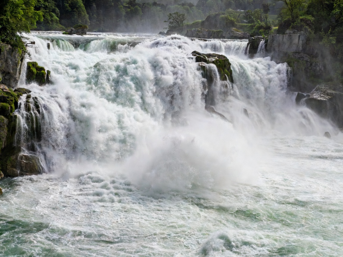
Where the harder limestone meets soft glacial gravels, the river eroded the soft deposits rapidly, leaving a vertical rock step 23 meters high. In the middle of the river still stand two massive limestone monoliths, remnants of the original pre-erosion cliff face that stubbornly resist the immense frictional erosion of the river.
Hydraulic Volume and Energy
Unlike slender vertical drops in alpine valleys, the Rhine Falls is defined by volume and horizontal spread. The average summer flow approaches 600,000 liters per second (600 m³/s), with historical high-water marks exceeding 1,250 m³/s during severe Alpine snowmelts accompanied by heavy rainfall.
The sensory impact at ground level is distinguished by low-frequency acoustic vibrations that can be felt through the bedrock surrounding the river banks. Below the drop, a violent plunge pool reaches depths of 13 meters, generating standing waves and counter-current eddies that make direct navigation near the base extremely challenging.
Expedition Advantages
- Unsurpassed kinetic volume and hydraulic water displacement.
- Historic vantage points from Laufen Castle and Wörth Castle.
- Fully integrated Swiss rail transit with platforms at Neuhausen Rheinfall.
Logistical Considerations
- Significant commercial development around perimeter infrastructure.
- Access fees apply to the prime viewing terraces below Laufen Castle.
- River boat shuttles to the central rock monolith cease during extreme currents.
Observation Infrastructure: Laufen vs. Wörth
Visitors can approach the falls from both northern and southern riverbanks. On the southern bank, Schloss Laufen provides cliffside elevator access down to the Känzeli terrace—a cantilevered iron platform positioned inches from the churning cascades, offering immersive exposure to the mist plume.
The northern bank at Schlössli Wörth offers sweeping horizontal vistas of the entire 150-meter breadth and serves as the launch point for specialized ferries that navigate the roiling lower pool to deliver visitors directly to the stairs of the central rock pillar.